
 Yahoo Sports
 Here’s why the WA fire season forecast has officials worried about this summer
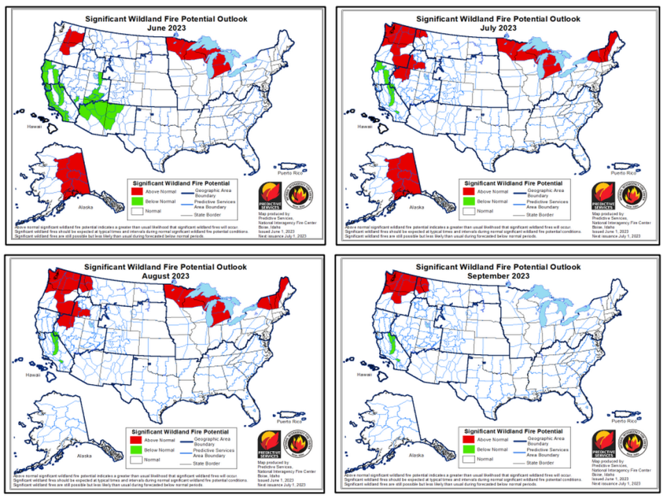
Washington state is expected to have a worse fire season than normal this summer through September.
In Eastern Washington, including the east Cascade Mountains, the above normal potential for significant wildfires starts this month.
But by July nearly all of the state, with the exception of parts of Garfield and Asotin counties in the southeast corner Washington, will have an above normal potential for significant wildfires, according to the National Interagency Fire Center.
The heat is to blame, it said.
In Washington state hot weather came early this year with temperatures in May ranging from 3 to 10 degrees above normal, with the temperatures the furthest above normal in Northwest Washington, according to Oregon State University.
The Hanford Meteorology Station north of the Tri-Cities reported that May temperatures averaged 5.7 degrees above normal.
It was the third warmest May on record there, and five daily hot weather temperature records were set, according to data collected back to the mid 1940s.
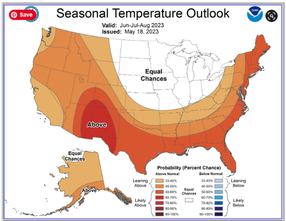
Looking forward, the National Weather Service predicts up to a 50% chance of higher than normal temperatures in Washington state from the Cascade Mountains east through August and up to a 40% chance of higher than normal temperatures in Western Washington.
Up to a 40% chance of below normal precipitation is forecast for the entire state this summer.
Warmer than normal weather and below normal precipitation already have caused “a precipitous decline in snowpack across Washington,” according to the National Interagency Fire Center.
Snowpack levels were average in the state at the start of May in Washington, but a month later are below average, said the center.
The U.S. Drought Monitor says parts of Washington state are starting the fire season abnormally dry.
That includes Southeast Washington, including Franklin County, and much of the western half of the state. The northwest corner of the state is in worse shape with moderate drought.

But overall the state starts the annual fire season with significantly less drought than in some recent years.
A year ago the state of Washington lifted a year-long drought alert for Eastern Washington.
In 2021, Franklin County was rated as being in extreme drought and Benton County was rated as being partly in extreme drought and partly as exceptional drought, the worst rating possible.
More wildfires mean more smoke.
Parts of Washington, including the Tri-Cities had haze and some deteriorated air quality the third week of May due to smoke from Canadian wildfires.
In the Tri-Cities, the air quality briefly reached the stage considered unhealthy for sensitive groups.
The North American Seasonal Fire Assessment predicted weather favoring increased fire activity from May through June in British Columbia north of Washington with that moderating to just the southern half of British Columbia in July.
Haze and smoke returned to the Tri-Cities this past weekend with air quality deteriorating from good to the level rated as moderate.
