
 Yahoo Sports
 Severe weather, possible tornadoes headed toward Heartland and Midwest: What to expect
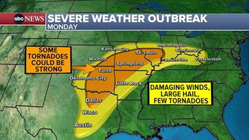
Severe weather is in the forecast for the Heartland and the Midwest, with damaging winds, large hail and even a few strong tornadoes possible.
On Monday, severe thunderstorms are expected from Texas to West Virginia, with the greatest tornado threat from Oklahoma to Missouri.
The Ohio River Valley from Louisville, Kentucky, to Cincinnati could also see tornadoes, but the threat there is not as high.
On Tuesday, as the storm moves east, the severe weather will concentrate from Mississippi to West Virginia, with the highest tornado threat from Tennessee to Kentucky.
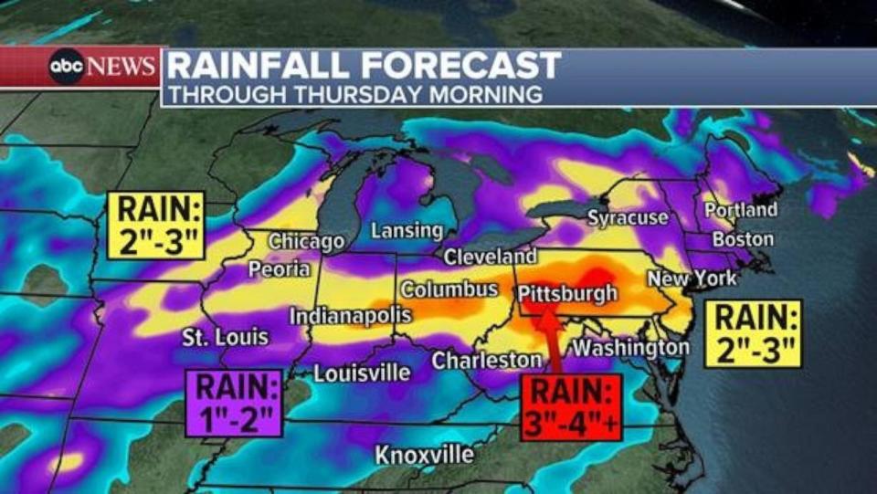
Meanwhile, a flood watch has been issued from Indiana to Maryland, where some areas could see up to 5 inches of rain over the next few days.
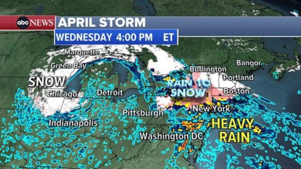
Some of that rain will then spill into the rest of the Northeast.
The heaviest rain will reach the Interstate 95 corridor, from Philadelphia to New York City to Boston, on Wednesday. Flash flooding is possible.
3 life-saving tactics to use if in a car during a flash flood
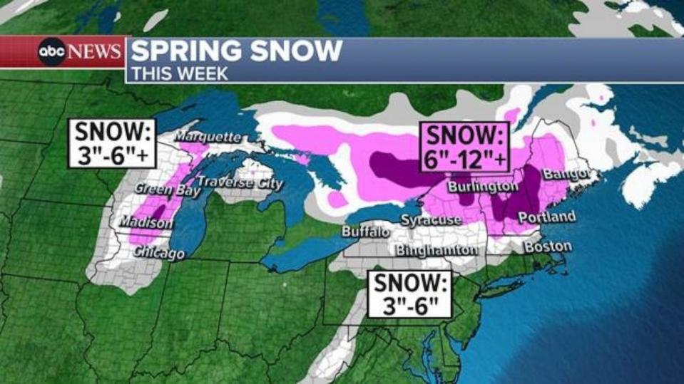
By Wednesday, snow is in the forecast for Indianapolis, Chicago and Green Bay, Wisconsin.
On Wednesday evening, snow will hit inland Pennsylvania, upstate New York and New England. More than 1 foot of snow is possible from the northern Great Lakes into the New England mountains by Thursday.
Severe weather, possible tornadoes headed toward Heartland and Midwest: What to expect originally appeared on abcnews.go.com

