
Photos: What Mount Slesse, site of the Flight 810 crash, looks like from the ground today


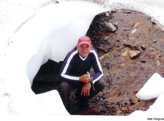
CFL history has been coming to life in TSN's Engraved On A Nation documentary series (full videos of the films and behind-the-scenes information available here), and the latest entry, "The Crash," did an excellent job of exploring the 1956 Trans-Canada Air Lines Flight 810 crash that killed 62 people, including five Canadian football stars. Earlier, I spoke with director Paul Cowan about the film, which focused on current Calgary Stampeders' offensive lineman Edwin Harrison and his quest to learn more about his grandfather, Cal Jones, a star Winnipeg Blue Bombers' offensive lineman who was killed in the crash. It ended with some particularly poignant footage of Harrison and his wife hiking Chilliwack, B.C.'s Mt. Slesse to look at where the flight crashed. What's interesting is that the trail they took is accessible to the public, and it contains some notable memorials to the crash. I spoke to Ken Wolgram, who hiked the trail in the summer of 2010 with his son, Matt, and he said while it can be a challenging climb, it's well worth undertaking for those interested in the history of the crash.
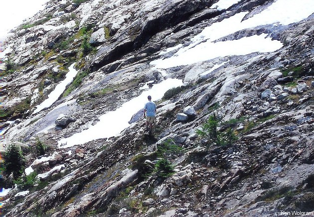
"It's a fantastic hike," Wolgram said. "It's a beautiful hike, with great views of the opposite side of the valley toward Mount Rexford and the international mountains in Washington state."

Of course, it's not the easiest hike to do, and weather conditions play a significant factor, as the area's covered in snow much of the year.
"They have very deep snow there," Wolgram said. "Over the winter, there has to be about 10 feet of snow."

Some small rocks fall down the steep parts of the mountain frequently, too, which hikers should be aware of.
"There's a lot of rock there," Wolgram said. "You can hear the rock coming down."
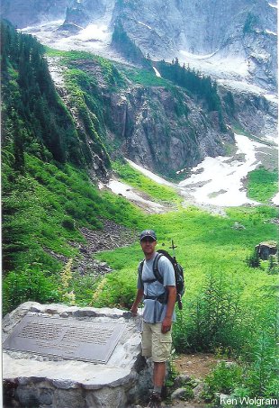
There are several memorials to the crash, including a plaque that looks out over the inaccessible location where the majority of the wreckage lies. A shot of Harrison near that plaque was used to close the documentary. Wolgram said it doesn't take too long to reach that point.
"In about three hours, you can get to the memorial plaque," he said.
He said the hike really illustrates what a tragedy the crash was.
"It's also very humbling when you get to the face of the vertical slab that the plane smashed into and consider what happened there; the sudden and catastrophic loss of life and how the plane might have cleared the jagged peak with only metres more elevation," Wolgram said.
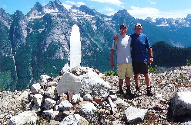
There's a memorial cairn further up incorporating parts of the wreckage, including a propeller from the flight.
"There's an original seat and some other miscellaneous bits," Wolgram said.
Wolgram said the remoteness of the site makes it clear why the wreckage from the Dec. 9, 1956 crash wasn't found until May 1957.
"It's understandable why it took months to find the wreckage," he said. "The site is high above the valley bottom and not easily seen from the access road or the trail until you hike up quite a way. With snow falling in November, the wreckage would have quickly frozen and been buried over the winter months."

Wolgram said the hike's well worth it for those who love history and the outdoors.
"It's a very interesting site, and a beautiful hike too."
