
 Yahoo Sports
 Warm sunshine, cold rain dominate Canada’s long-weekend forecast
The unofficial start to summer is finally here and folks from Squamish to St. John’s are hoping to head outdoors and enjoy the long weekend.
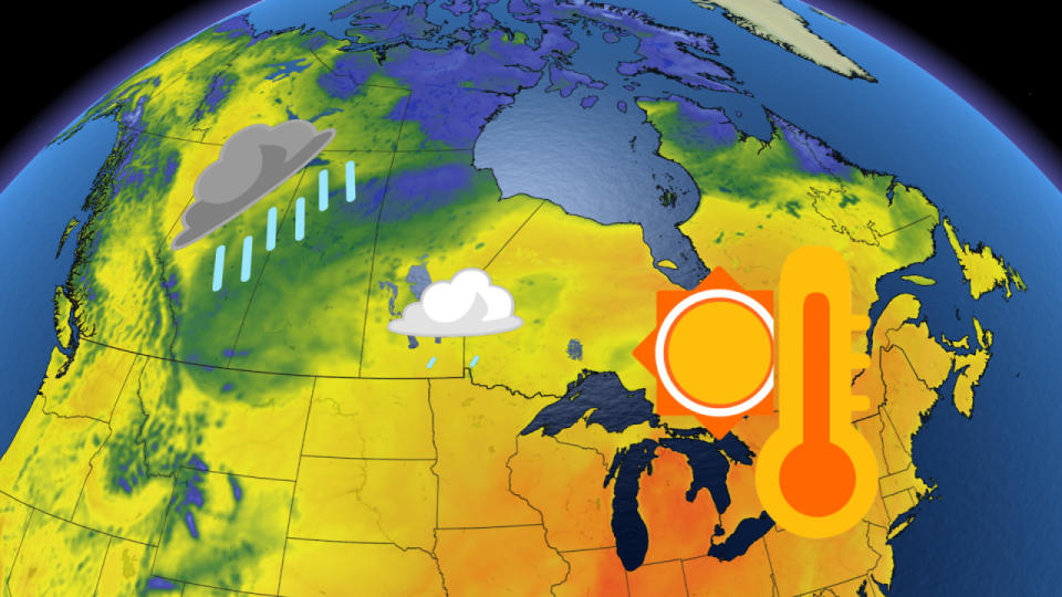
Whether you’re hitting the trails or just grilling burgers in the backyard, you may have to watch the skies at times across parts of the country. A few spots will get an early tease of summer, but the May long weekend will feel very much like typical May for many.
Don’t forget your sunscreen if you’re heading out—and beware the frigid waters if you’re hoping to take a dip.
DON’T MISS: Three things you'll want to keep in mind this long weekend
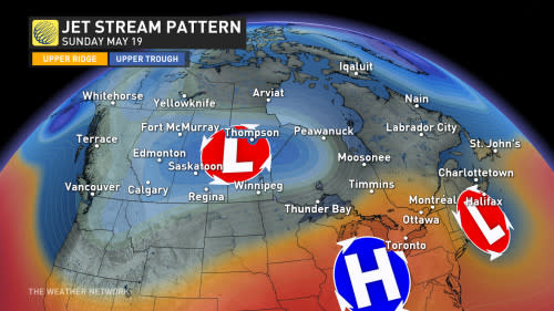
This weekend’s jet stream over Canada will dictate the terms by which we enjoy the long holiday across the country.
A wavy pattern will bring varied weather from coast to coast, with some nice weather in British Columbia contrasting with periods of rain expected on the Prairies. Additional rain isn’t completely unwelcome news heading into wildfire season.
Back east, a ridge building over the Great Lakes and East Coast will allow generally pleasant weather to dominate the region. Folks around Ottawa and Montreal could see the country’s warmest weather, which is fantastic news for any outdoor plans.
A mixed bag in store for the western half of Canada
British Columbia will see fine weather with a slight caveat. A strong ridge just off the West Coast will be a touch too far away from the province to protect it from a threat for showers.
Communities like Vancouver can expect some showers and slightly cooler-than-seasonal temperatures for the duration of the long weekend. It’s not a washout by any means, but keep an eye on the sky just in case.
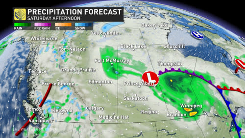
A broad trough lurking over the Rockies will bring a spell of dismal weather to much of the Prairies for the long weekend. Folks across the southern Prairies can expect rain heading into Saturday, with the precipitation pushing north through the remainder of the weekend.
CANADA'S WILDFIRES: Visit The Weather Network's wildfire hub to keep up with the latest on the active start to wildfire season across Canada.
While rain on the Prairies isn’t great for outdoor activities, what really matters is that it’s liquid relief for the parched soil and areas dealing with awful wildfires. We’ll take what we can get this time of year.
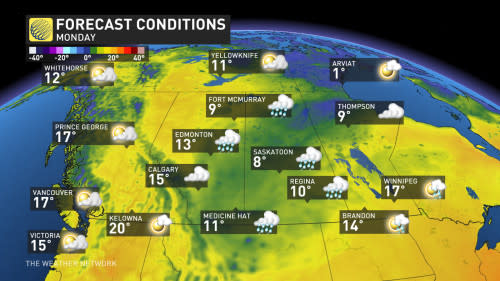
Winnipeg may begin the weekend on the milder side, but expect below-seasonal temperatures to blanket the Prairies for the duration of the long weekend.
A tease of summer back east
Things are looking better back east as a ridge building over the Great Lakes region acts like a guard rail preventing the cold air from marching east.
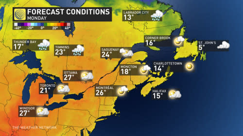
Good news is on the way from the Greater Toronto Area up toward cottage country as seasonably warm temperatures and dry conditions are on tap for southern Ontario and southern Quebec. Our ridge will force cold air to stall to the west while precipitation detours into northern Ontario and western Quebec.
Daytime readings around Ottawa and Montreal could even poke into the upper 20s at times this weekend.
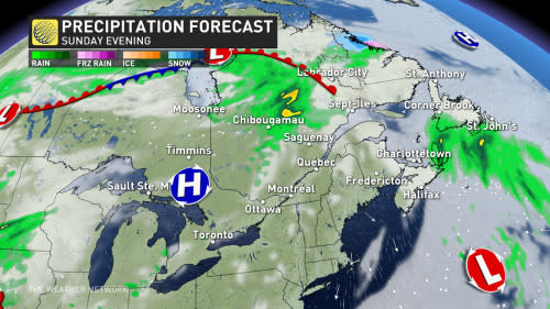
Much like our friends over on the West Coast, the country’s eastern shores will have a bit of a mixed bag heading into the three-day holiday. The weekend will start out dry across Atlantic Canada, especially for folks in Newfoundland.
A system is lurking on the horizon as the weekend wears on. This disturbance will move into Nova Scotia later in the day Saturday, eventually pushing into southeastern Newfoundland on Sunday and into Monday. Keep an umbrella handy if you’re in Halifax or St. John’s.
Stay aware of chilly water temperatures
This weekend may serve as the unofficial kickoff to the summer season, but waters across the country are very slow to catch up as the seasons change.
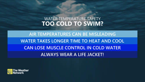
Forecasters expect water temperatures to remain in the lower double-digits this weekend off B.C.’s Lower Mainland and for portions of Lake Erie and Lake Ontario. Ocean temperatures off the East Coast largely remain in the lower single digits.
Take special care if you’re planning to go swimming this weekend, keeping water temperatures and basic precautions in mind to ensure the whole family has safe fun through the holiday.
Stay with The Weather Network for all the latest on your long-weekend forecast across Canada.

