
 Yahoo Sports
 Nothing says spring like freezing rain warnings, and 25+ cm of snow
As we march even deeper into the heart of the spring season, many parts of Canada are finding it tough to find any consistent signs of warming weather. Add to the mix periods of snow and wintry precipitation, and it's safe to say the winter season is certainly not going out without a strong fight.
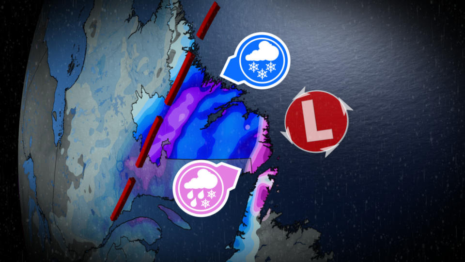
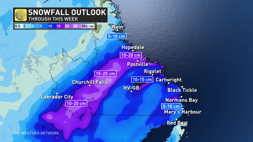
This week, parts of the East Coast will bear the brunt of the winter weather, with multiple rounds of April snowfall stacking up in Labrador. The chances for snow flurries will stick around all week long, bringing as much as 25 cm for some. In addition, freezing rain warnings lined parts of the south coast Wednesday morning.
MUST SEE: Extreme pattern over Arctic produces 50+ degree temperature spread
Although 25+ cm of snow in April may seem extreme, for this part of the country, it's definitely nothing out of the ordinary. In fact, the month as a whole brings about 40-50 cm of snow to Labrador on average.
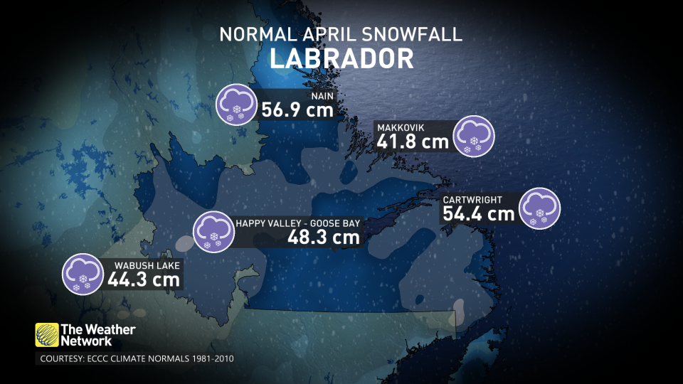
Some communities, including Nain, even have snowfall chances stretch all the way into June!
"This week will be a little bit different however, as some regions could reach about half of Labrador's monthly averages alone," says Rachel Modestino, a meteorologist at The Weather Network.
The first round of snowy weather hit the region on Tuesday, with gusty winds making for some tricky travel and miserable conditions.
RELATED: When should you switch to winter tires? Provincial breakdown, here
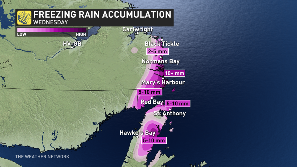
By early Wednesday morning, freezing rain warnings lined the south coast, with the threat for 5-10 mm of icy precipitation. The ice accumulation will likely be more widespread in the interior and mountainous terrain where temperatures are expected to remain below freezing the longest.
This could lead to slick driving conditions, and the potential for power outages, as well.
The next round of snow builds in through the day on Thursday, as another system curls in from Newfoundland.
There is a chance for lingering icy precipitation along the coast from Red Bay to Norman's Bay early Thursday, and a significant burst of snowfall inland and north.
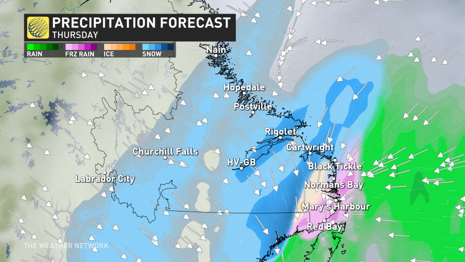
As the system departs, northerly winds with gusts between 50-70 km/h will pick back up, along with wrap-around flurries along the coast.
While there is some uncertainty with exact totals, as much as 25 cm is not out of the question for the higher elevation regions by Friday. Between 10-20+ cm is expected widespread along the coast, but the icy precipitation or mixing could lessen totals for some.
Travel impacts are likely to persist through Thursday, so be sure to plan ahead, and adapt to the changing conditions.
