
 Yahoo Sports
 Severe thunderstorm watch issued for North Texas; large hail, tornadoes possible
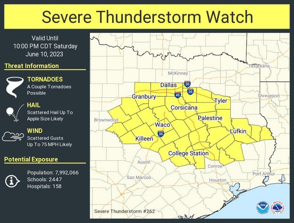
A severe thunderstorm watch has been issued for North Texas until 10 p.m. Saturday, according to the National Weather Service.
The affected areas include Fort Worth, Dallas, Granbury, Waxahachie, Corsicana, Waco, Palestine and Killeen.
A couple of tornadoes, hail up to the size of an apple and scattered wind gusts of up to 75 miles per hour are possible Saturday, the NWS said. Isolated flash flooding could also occur.
Tarrant and Dallas counties and counties to the south are included in the area at the highest risk for severe storms and flash flooding.
The outflow boundary, which will focus on afternoon and evening thunderstorm development, now stretches from Rockwall to the Dallas-Fort Worth area to Decatur to Wichita Falls.
Any storms that will develop in the afternoon will likely quickly become severe, according to the NWS.
Weather watches and warnings
A live data feed from the National Weather Service containing official weather warnings, watches, and advisory statements. Tap warning areas for more details. Sources: NOAA, National Weather Service, NOAA GeoPlatform and Esri.
Storm Reports
This map contains continuously updated storm reports and damage from the National Weather Service for the past 48 hours. Reports include tornado, wind storm and hail storm reports. The map also includes tornado reports for the past week and recent rainfall accumulations. Sources: National Oceanic and Atmospheric Administration (NOAA), Esri.
