
 Yahoo Sports
 Messy weather will accompany temperature rebound in Ontario

Ontario’s long-range forecast is a drastic change from the recent extreme cold. This week the primary flow of air will be from the Gulf of Mexico, which will cause temperatures to rise above 0°C.

The first low pressure system will slide across the province on Tuesday and bring primarily rainy conditions to the south and snowfall across the north. Cottage country will see a wintry mix with most of the snow falling across northeastern Ontario.

The forercast becomes more interesting by Thursday as a Texas low draws up a warmer, moist flow from the Deep South. With so much warm air aloft, there's a risk of freezing rain across the higher terrain of southern Ontario and a mess is guaranteed to unfold across regions farther north.
SEE ALSO: Three things that made the Eastern Canada cold snap so bizarre
Huge differences in model scenarios range from very mild temperatures and rain from a system tracking northwest of the region to a wintry system with a track to the south of the region. Temperatures will soar into the mid-teens in Ohio, but it remains to be seen how far north the warm front tracks.
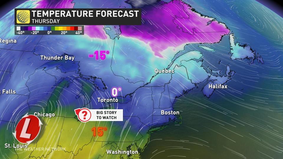
Hamilton and Niagara have the best opportunity to experience warm, double-digit February temperatures, while Toronto could very well be stuck in a chilly flow off the lake.
A couple more days of seasonal weather is possible next weekend, but a mild and active pattern is expected for the following week. Forecasters are watching the potential for winter to make a comeback late in the month.
Check back for updates as more granular details emerge for the tumultuous week ahead.
