Daily thunderstorms possible in Kansas City; see what to expect in your area
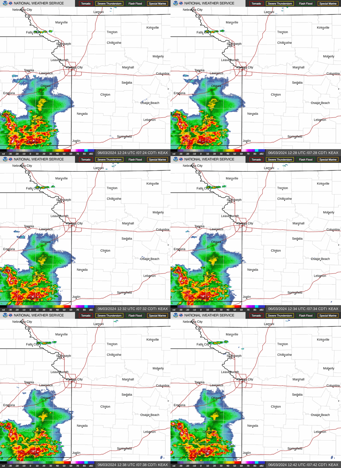
Pop up showers brought bursts of heavy rains to the Kansas City area early Tuesday, soaking some rush hour drivers as they headed back to work after the holiday weekend, according to the National Weather Service.
The slow moving scattered storms stretched from Buchanan County to the north to Miami County to the south.
“Areas of heavy downpours are forming generally along the KS/MO border, from roughly St. Joseph, MO to Gardner KS,” the weather service said on social media. “Brief periods of heavy rain are expected with these, so be cautious on that morning commute.”

The storms are ushering in what could be a week where daily thunderstorms are possible in the Kansas City area. Widespread severe weather is not expected, the weather service said.
On Tuesday, thunderstorms will be possible mainly in northeast Kansas and northwest Missouri. These storms will be able to generate gusty winds up to 50 mph and hail up to one-inch in diameter. Thunderstorms are expected to begin moving through the area around 3 p.m. and continuing until 7 to 9 p.m., the weather service said.
The Kansas City metro area’s chance for thunderstorms is about 50%.
The possibility of thunderstorms continues each afternoon Wednesday through Saturday as well. Severe weather is not expected with those storms, although strong wind gusts and small hail is possible.
Thunderstorm chances are less than 40% Wednesday and Thursday and just shy of 60% on Friday.
The rain would be a welcomed sight for the Kansas City area, which is facing abnormally dry to moderate drought conditions. It’s been very dry across the region the last couple of months. Typically, this is the wettest time of the year for Kansas City.
It also will be a hot week in Kansas City, where temperatures will soar to around 90 degrees each day. The normal temperature for this time of year in Kansas City is 80 degrees.
Weather watches and warnings
A live data feed from the National Weather Service containing official weather warnings, watches, and advisory statements. Tap warning areas for more details. Sources: NOAA, National Weather Service, NOAA GeoPlatform and Esri.

 Yahoo Sports