
 Yahoo Sports
 Cold weather arrives in Southern California, bringing snow in the mountains
Cold weather moved into Southern California on Sunday, bringing rain, cloudy skies and snowfall in the mountains.
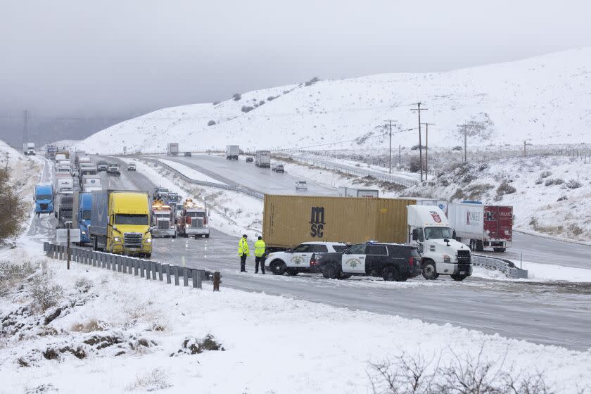
The weather that swept in from the north was forecast to drop 6 to 10 inches of snow at elevations above 5,000 feet in the San Gabriel Mountains, and as much as a foot of snow at high elevations in the mountains in Riverside, San Bernardino and San Diego counties.
The National Weather Service said the cold weather would bring snow at elevations as low as 2,500 feet, and could leave up to 2 inches on mountain passes including the Grapevine on Interstate 5. Forecasters warned the snow could make for slippery driving on roads in the mountains.
The low-pressure system came down from Canada over land, said David Sweet, meteorologist with the National Weather Service in Oxnard.
“It's got a lot of cold air with it. And it's going to drop our snow levels down quite low,” Sweet said.
“Slippery roads are possible. Snow is expected to affect the Grapevine. So there could be some hazardous road conditions,” Sweet said. “People above 2,500 to 3,000 feet should be prepared for the possibility of winter road conditions.”
In the Los Angeles area, light rain was expected, with highs in the mid-50s and overnight lows in the low 40s.
The National Weather Service issued a winter storm warning for mountain areas in San Bernardino, Riverside and San Diego counties, forecasting heavy snow and wind gusts of 30 mph to 60 mph in some areas.
In Los Angeles County’s mountains, 2 to 5 inches of snow was forecast between 3,000 feet and 4,500 feet, with 4 to 8 inches of snow at higher elevations.
Parts of the high desert are also expected to get snow — as much as 3 inches in the foothills of the Antelope Valley, and somewhere between a trace of snow and an inch on the valley floor around Palmdale.
“Some folks that are not used to snow will probably have an opportunity to see a little bit of snow,” Sweet said.
Elsewhere in the state, the weather brought showers in the Central Valley and fresh snow in the Sierra Nevada. After 10 days without snow, about 0.8 inch of snow fell Sunday morning at the UC Berkeley Central Sierra Snow Laboratory at Donner Pass, and more was coming down.
The fresh snowfall brought a light addition to the Sierra snowpack after storms in the first half of January gave California its deepest snow in years. The snow water equivalent of the Sierra Nevada snowpack now measures 214% of average for this time of year, bringing a significant boost to California’s water supplies after three years of severe drought.
The snowfall in this latest weather system is “not overly impactful compared to what we've seen for the first half of January,” said Katrina Hand, a meteorologist with the National Weather Service in Sacramento. She said 3 to 8 inches of snow was expected on mountain passes, with larger amounts at higher elevations.
In parts of the Sierra Nevada, drivers were advised to use chains.
“If people do have mountain travel plans, expect some travel delays and slick roads,” Hand said.
The storm was expected to drift southward off the coast of Southern California by Monday night, leaving the snow-covered mountains under clear skies by Tuesday.
This story originally appeared in Los Angeles Times.
