'Super squalls' threaten extra 40 cm of snow for parts of Ontario

A powerful, and certainly memorable, lake-effect snow event will continue to batter parts of southern Ontario Saturday and Sunday. Multiple squalls will threaten an additional 30-40 cm of snow in some regions, so keep the snowblowers and shovels ready. The setup will be conducive for one or more "super-snow squalls" to develop, measuring an impressive 500+ km in length.
MUST SEE: Buried: Why the Great Lakes produce some of the world’s heaviest snow
Significant snowfall rates in the hardest-hit regions will produce near-zero visibility and challenge road crews to keep thoroughfares clear for any appreciable amount of time.
Thundersnow! Nailed it! Whoooooo! @weathernetwork #NYwx #onstorm pic.twitter.com/VlUU4Xm4l2
Thundersnow! Nailed it! Whoooooo! Mark Robinson on Twitter: "Thundersnow! Nailed it! Whoooooo! @weathernetwork #NYwx #onstorm pic.twitter.com/VlUU4Xm4l2 / Twitter" Mark Robinson on Twitter: "Thundersnow! Nailed it! Whoooooo! @weathernetwork #NYwx #onstorm pic.twitter.com/VlUU4Xm4l2 / Twitter" Mark Robinson on Twitter: "Thundersnow! Nailed it! Whoooooo! @weathernetwork #NYwx #onstorm pic.twitter.com/VlUU4Xm4l2 / Twitter" Mark Robinson on Twitter: "Thundersnow! Nailed it! Whoooooo! @weathernetwork #NYwx #onstorm pic.twitter.com/VlUU4Xm4l2 / Twitter"
— Mark Robinson (@StormhunterTWN) Mark Robinson on Twitter: "Thundersnow! Nailed it! Whoooooo! @weathernetwork #NYwx #onstorm pic.twitter.com/VlUU4Xm4l2 / Twitter"
Environment and Climate Change Canada (ECC) is urging people to consider postponing non-essential travel until conditions improve. Road closures are possible this weekend. If you must travel, keep others informed of your schedule and destination and carry an emergency kit and mobile phone.
STAY SAFE: The do's and don'ts of shovelling snow
This is already an event for the record books for folks south of the border. The U.S. National Weather Service office in Buffalo, N.Y., reported that Orchard Park, a town south of Buffalo, had seen 167 cm (66 in) of snow as of Friday evening.
If verified, that would beat the highest total in the legendary lake-effect snowstorm that occurred eight years ago this week.
WATCH: 'Thunder-snowstorm' dumps incredible amount of powder in N.Y.
Intense snow squalls over eastern Lake Ontario and Lake Erie will drift northward to impact the areas through much of Saturday. This snow squall will move out of the regions in the overnight hours.
However, for areas near Georgian Bay, it's a bit of a different story. Snow squalls are forecast to move back into the region Saturday overnight, continuing through Sunday evening before wrapping up as the night progresses.

We’re on track to see an additional 30-40 cm of snow across the Bruce Peninsula and northern sections of cottage country through Sunday, as another intense squall will move in over Lake Huron and Georgian Bay.
Another snow squall over Lake Ontario will bring significant snows to portions of eastern Ontario, with 15-30 cm of additional snowfall possible through the weekend along the 401 from Cobourg to Kingston.
Farther south, the same squall burying the Buffalo metro area will drift north and begin dropping heavy snow across the Niagara region. Widespread snowfall totals of 15-30 cm are likely across the northern Erie shores, with even higher totals possible south of Niagara Falls toward Fort Erie.

Much of this additional heavy snow will fall in extra-long snow squalls that could measure 500+ km in length at times on Saturday. Why is this happening? It’s all in the winds.
Lake-effect snow forms when cold winds blow over the warm lakes. These intense snow squalls develop when the wind achieves a long fetch, or spends a lot of distance blowing over the water.
Sometimes, though, the winds align just right so that they blow over a very long length of lakes Erie, Ontario, Huron and Georgian Bay to create two extended snow squalls. This is the setup we’re likely going to see build on Saturday.
MUST SEE: Epic thundersnow captured amid 'electrically active' snow squall
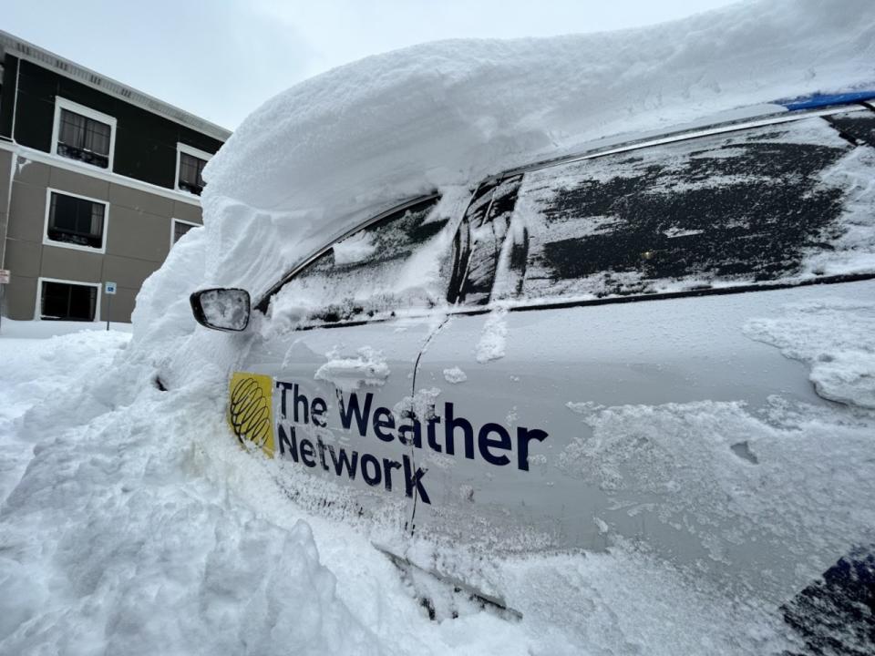
WATCH: Powerful Buffalo squalls put into perspective as car completely buried
Thumbnail courtesy of Toby Heyworth, taken in Amaranth, Ont.
Stay tuned to The Weather Network as we monitor this developing lake-effect snow event.

 Yahoo Sports